WorldNew Google Maps images reveal massive scale of devastation in Gaza
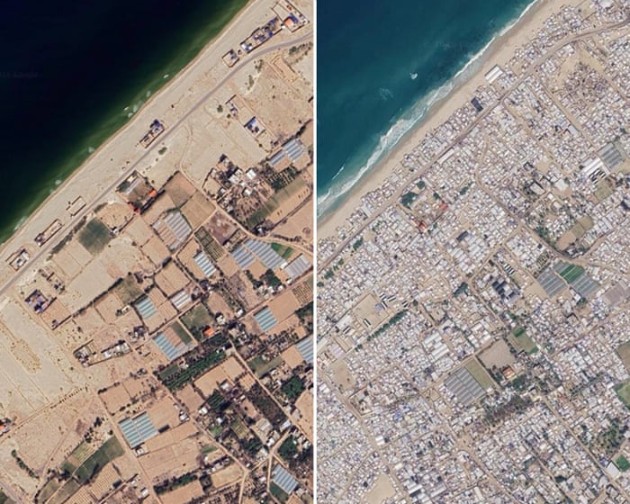
Updated Google Maps satellite imagery shows further destruction of homes, businesses, places of worship and infrastructure in Gaza since a fragile ceasefire took effect. It depicts tent camps along much of the shoreline and Rafah largely reduced to rubble. More than 2.1 million displaced people are living in temporary shelters, while about 82% of structures have been damaged, according to Unrwa.
TThe Guardian★★★★★2026-10-01 04:00Original
New Google Maps images reveal massive scale of devastation in Gaza
 World
WorldMAJOR